

“You are being watched, a machine that spies on you every hour of every day”
This idea started due to the fact that Google keeps sending notifications with “review your last month”. On my first attempt when I tried to download my location history I noticed there were two methods of exporting data, either .kml or .json. None of these exports are “geo-friendly” and some processing is required to make any use of this data.
There are a few websites that you can load your history into and will create a heatmap of the places you’ve been, such as this..
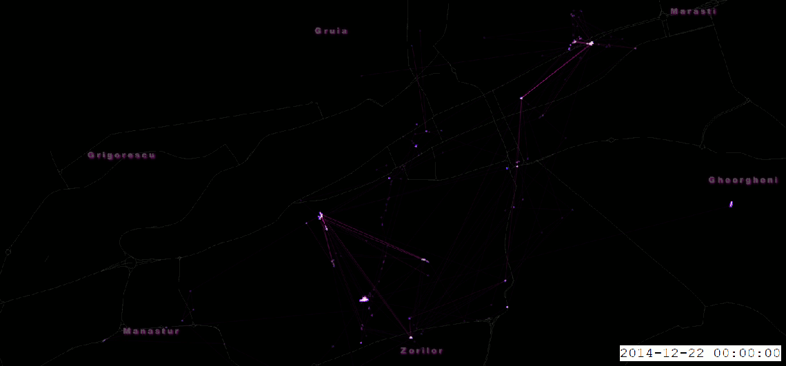
This did not suffice my needs, since I wanted to be able to filter out areas, or remove bad data ( phone gps kept localizing me in New York even thou I’ve never been to the US. Searching on github I came across a working script at here that exports the data in a csvfile (lat,long,timestamp). After loading it up in Qgis, the points were merged by time stamp, having created a polyline for each day independently. After styling the points and lines frames were exported with Qgis plugin Time Manager and merged in GIMP.
Looking at the result and knowing the layout of the city I can easily make out the places I’ve been to the most, -home-city center-work. It’s quite creepy when you realize how much we are being tracked, our every single move being recorded.

This looks interesting–how’d you get Google location data into QGIS?
LikeLiked by 1 person
https://github.com/Scarygami/location-history-json-converter but there are multiple ones, this seemed to work without any modifications. I am going to add more details to the post, i just haven’t found the time yet, it’s still under construction
LikeLiked by 1 person